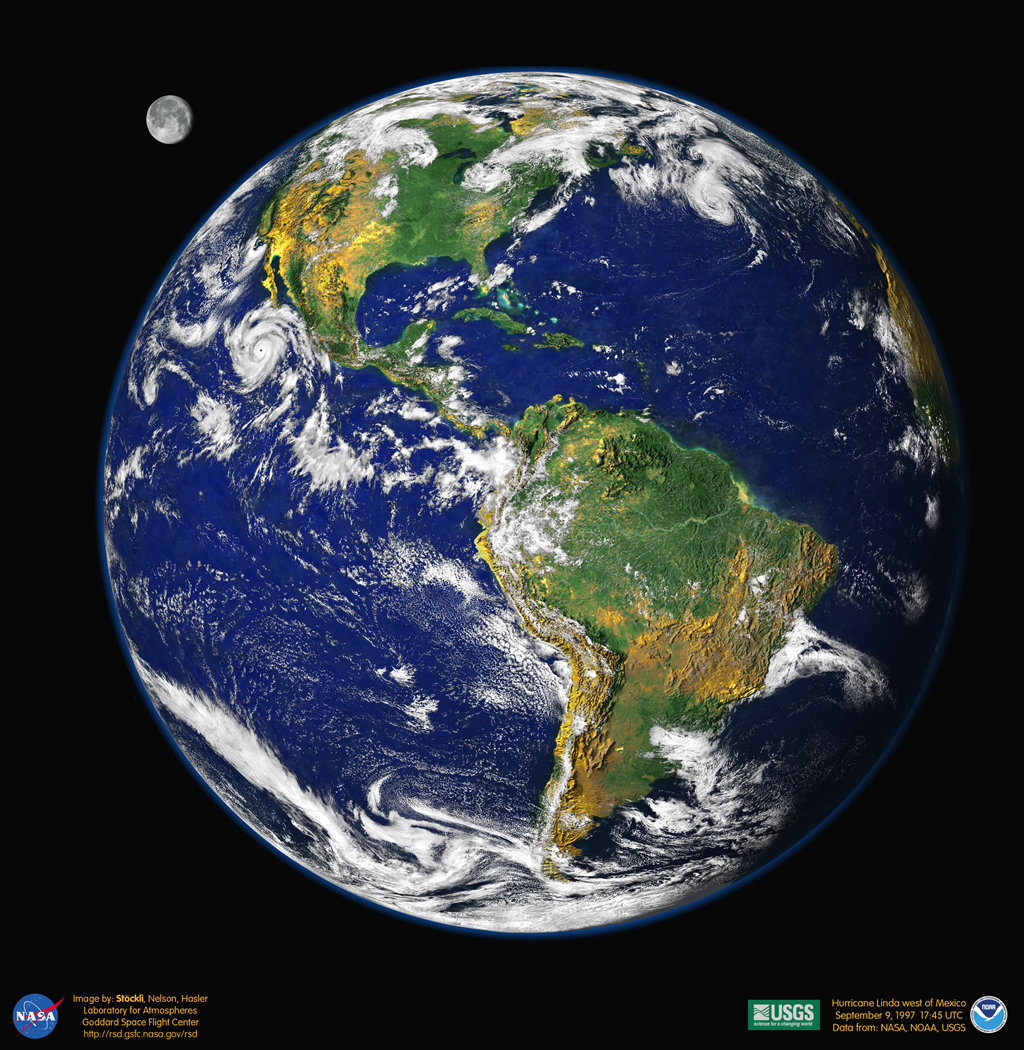
This reconstructed digital portrait of our planet is reminiscent of the Apollo-era pictures of the "big blue marble" Earth from space. To create it, researchers at Goddard Space Flight Center's Laboratory for Atmospheres combined data from a Geostationary Operational Environmental Satellite (GOES), the Sea-viewing Wide Field-of-view Sensor (SeaWiFS), and the Polar Orbiting Environmental Satellites (POES) with a USGS elevation model of Earth's topography. Stunningly detailed, the planet's western hemisphere is cast so that heavy vegetation is green and sparse vegetation is yellow, while the heights of mountains and depths of valleys have been exaggerated by 50 times to make vertical relief visible. Hurricane Linda is the dramatic storm off North America's west coast. And what about the Moon? The lunar image was reconstructed from GOES data and artistically rescaled for this visualization.
Este retrato digital reconstruido de nuestro planeta evoca las imágenes de la era Apolo de la Tierra como la "gran canica azul" vista desde el espacio. Para crearlo, investigadores del Laboratorio de Atmósferas del Centro de Vuelo Espacial Goddard combinaron datos de un Satélite Operacional Ambiental Geoestacionario (GOES), el Sensor de Campo de Vista Amplio para Observación del Océano (SeaWiFS) y los Satélites Ambientales en Órbita Polar (POES) con un modelo de elevación topográfica de la Tierra del USGS. De detalle sorprendente, el hemisferio occidental del planeta se presenta de manera que la vegetación densa es verde y la vegetación dispersa es amarilla, mientras que las alturas de las montañas y profundidades de los valles se han exagerado 50 veces para que el relieve vertical sea visible. El Huracán Linda es la dramática tormenta frente a la costa occidental de América del Norte. ¿Y la Luna? La imagen lunar fue reconstruida a partir de datos de GOES y reescalada artísticamente para esta visualización.