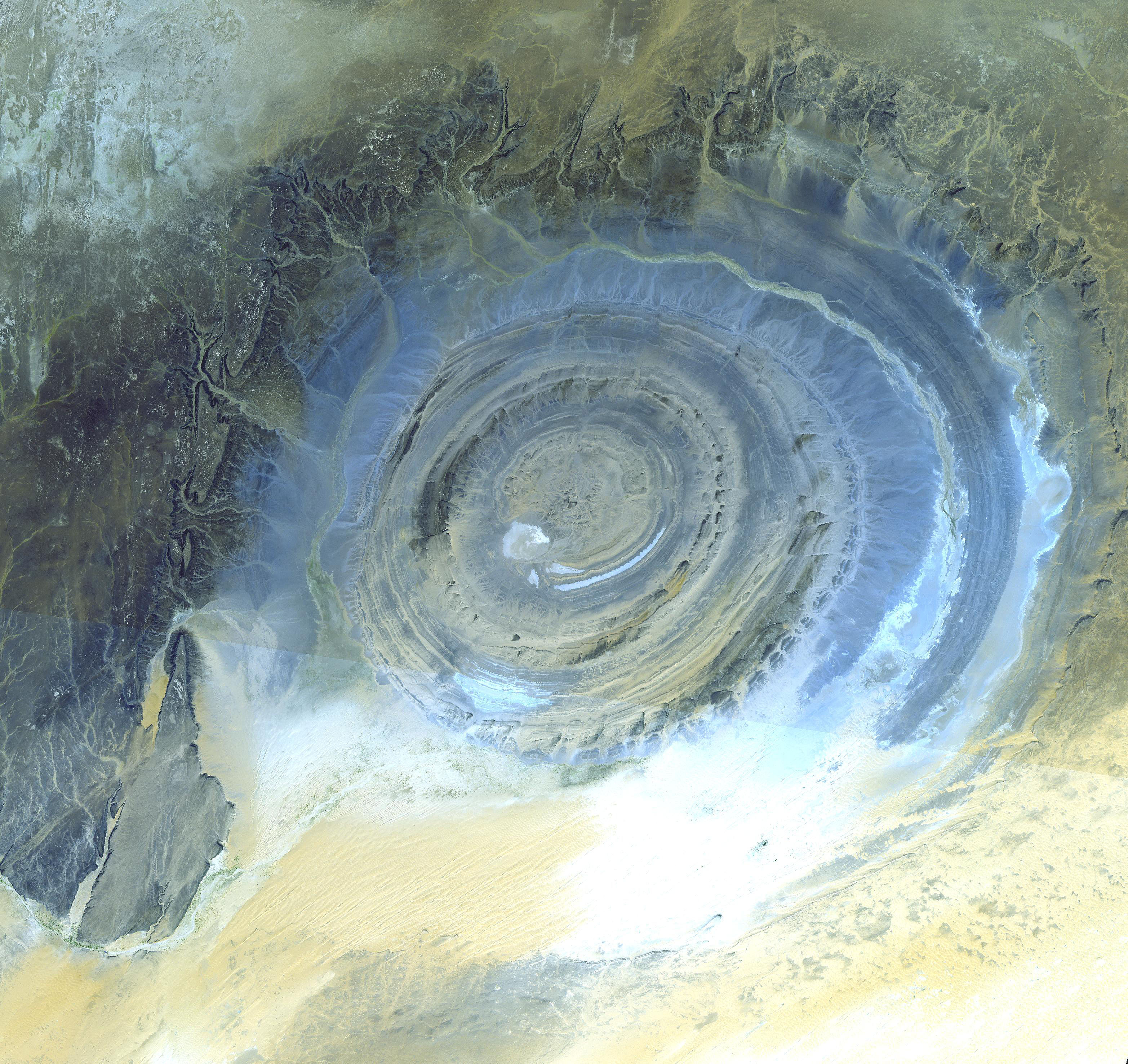
What on Earth is that? The Richat Structure in the Sahara Desert of Mauritania is easily visible from space because it is nearly 50 kilometers across. Once thought to be an impact crater, the Richat Structure's flat middle and lack of shock-altered rock indicates otherwise. The possibility that the Richat Structure was formed by a volcanic eruption also seems improbable because of the lack of a dome of igneous or volcanic rock. Rather, the layered sedimentary rock of the Richat structure is now thought by many to have been caused by uplifted rock sculpted by erosion. The above image was captured by the ASTER instruments onboard the orbiting orbiting Terra satellite. Why the Richat Structure is nearly circular remains a mystery.
¿Qué es eso en la Tierra? La estructura de Richat en el desierto del Sahara en Mauritania es fácilmente visible desde el espacio porque tiene casi 50 kilómetros de diámetro. En un momento dado se pensó que era un cráter de impacto, pero la superficie plana en su centro y la ausencia de roca alterada por choques indican lo contrario. La posibilidad de que la estructura de Richat haya sido formada por una erupción volcánica también parece improbable debido a la ausencia de un domo de roca ígnea o volcánica. En cambio, la roca sedimentaria estratificada de la estructura de Richat ahora es considerada por muchos como resultado de roca elevada tallada por la erosión. La imagen anterior fue capturada por los instrumentos ASTER a bordo del satélite en órbita Terra. Por qué la estructura de Richat es casi circular sigue siendo un misterio.
