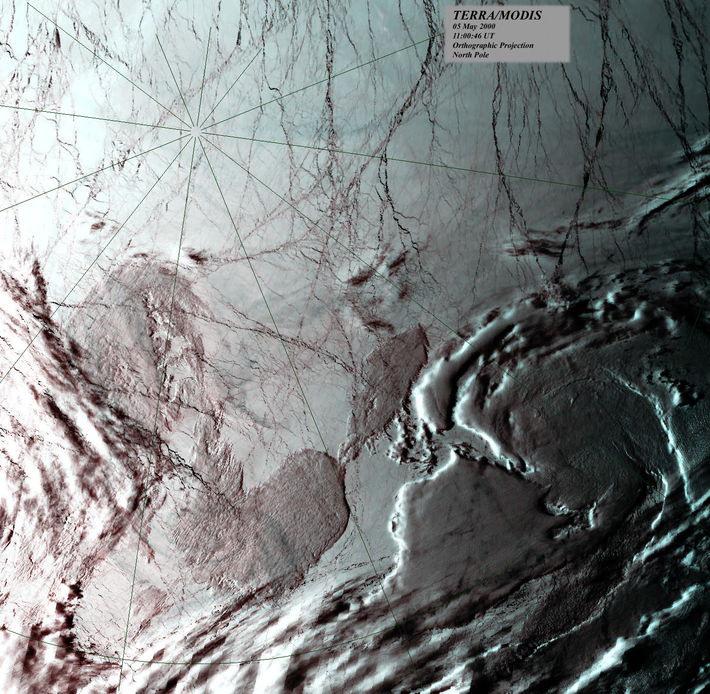
Orbiting over the north pole of planet Earth on May 5, the MODIS instrument on-board the Terra spacecraft, recorded this view of the ice cap 700 kilometers below. A radial grid centered on the pole is shown on top of the approximately true color image where each pixel covers about one square kilometer. Frozen sea ice appears whitish while open water or newly refrozen ice looks black. An impressive criss-crossing network of cracks in ice shifting above a liquid water ocean is visible, traced by the meandering dark lines. In fact, the dark network of cracks in the sea ice is reminiscent of another world in our solar system which may also harbor a liquid water ocean -- Jupiter's ice moon Europa.
Orbitando sobre el polo norte del planeta Tierra el 5 de mayo, el instrumento MODIS a bordo de la nave espacial Terra registró esta vista de la capa de hielo a 700 kilómetros de altitud. Sobre la imagen de color aproximadamente real se muestra una cuadrícula radial centrada en el polo, donde cada píxel cubre aproximadamente un kilómetro cuadrado. El hielo marino congelado aparece blanquecino, mientras que el agua abierta o el hielo recién recongelado se ve negro. Es visible una impresionante red entrecruzada de grietas en el hielo que se desplaza sobre un océano de agua líquida, trazada por las sinuosas líneas oscuras. De hecho, esta red oscura de grietas en el hielo marino recuerda a otro mundo de nuestro sistema solar que también podría albergar un océano de agua líquida: Europa, la luna helada de Júpiter.
