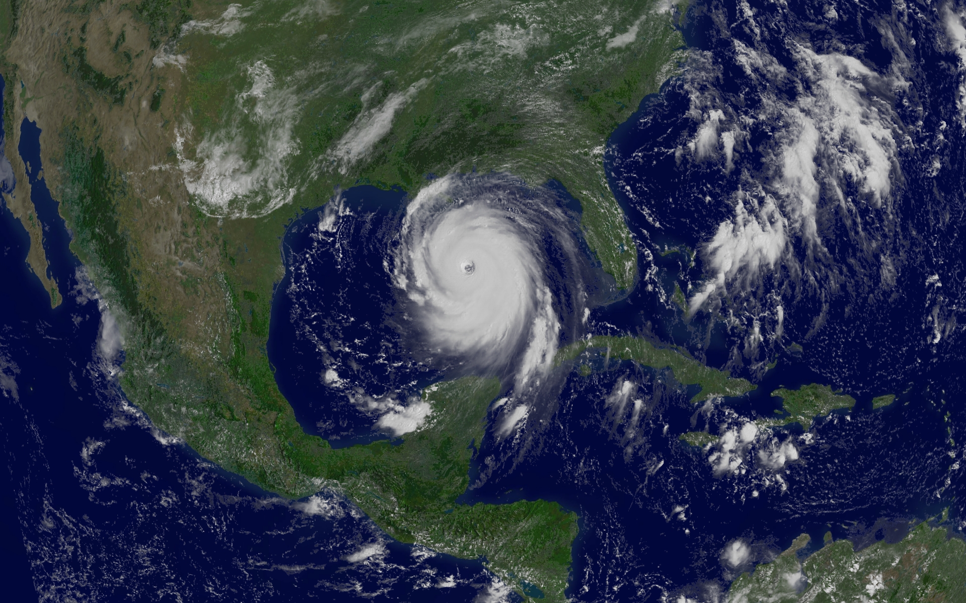
Where will Hurricane Katrina go? One of the stronger storm systems of modern times appears headed for landfall somewhere in the southern USA sometime today. Katrina was designated yesterday a rare Category 5 Hurricane, the strongest designation for a storm on Earth, and one that indicates sustained winds greater than 250 kilometers per hour. Pictured above is a digitally processed image from the orbiting GOES-12 weather satellite that shows the massive storm system yesterday in the Gulf of Mexico. Starting as a slight pressure difference, hurricanes grow into large spiraling storm systems of low pressure, complete with high winds and driving rain. A hurricane is powered by evaporating ocean water, and so typically gains strength over warm water and loses strength over land. Much remains unknown about hurricanes and cyclones, including how they are formed and the exact path they will take.
¿Hacia dónde se dirigirá el Huracán Katrina? Uno de los sistemas de tormentas más intensos de los tiempos modernos parece dirigirse hacia algún punto de tierra en el sur de Estados Unidos en algún momento de hoy. El Katrina fue designado ayer como un raro Huracán de Categoría 5, la designación más fuerte para una tormenta en la Tierra, que indica vientos sostenidos mayores a 250 kilómetros por hora. La imagen superior muestra una procesada digitalmente del satélite meteorológico GOES-12 en órbita, que capturó el masivo sistema de tormenta ayer en el Golfo de México. Comenzando como una leve diferencia de presión, los huracanes crecen hasta convertirse en grandes sistemas de tormentas en espiral de baja presión, completos con vientos fuertes y lluvia torrencial. Un huracán es impulsado por la evaporación del agua oceánica, y típicamente gana intensidad sobre aguas cálidas y pierde intensidad sobre tierra. Mucho sigue siendo desconocido acerca de los huracanes y ciclones, incluyendo cómo se forman y la trayectoria exacta que seguirán.