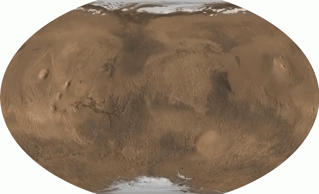
From pole to pole, from east to west, this is all of Mars. The above picture was digitally reconstructed from over 200 million laser altimeter measurements taken by the Mars Global Surveyor spacecraft currently orbiting Mars. The image strips Mars of its clouds and dust, and renders the whole surface visible simultaneously in its true daytime color. Particularly notable are the volcanoes of the Tharsis province, visible on the left, which are taller than any mountains on Earth. Just to the left of center is Valles Marineris, a canyon much longer and deeper Earth's Grand Canyon. On the right, south of the center, is the Hellas Planitia, a basin over 2000 kilometers wide that was likely created by a collision with an asteroid. Mars has many smooth lowlands in the north, and many rough highlands in the south. Mars has just passed its closest approach to Earth since 1988 and can be seen shining brightly in the evening sky.
Desde polo a polo, de este a oeste, esta es toda la superficie de Marte. La imagen mostrada fue reconstruida digitalmente a partir de más de 200 millones de mediciones tomadas por un altímetro láser del orbitador Mars Global Surveyor. La imagen elimina las nubes y la polvo, y representa la totalidad de la superficie simultáneamente en su color real de día. Particularmente notables son los volcanes de la provincia de Tharsis, visibles a la izquierda, que son más altos que cualquier montaña en la Tierra. Justo a la izquierda del centro se encuentra Valles Marineris, un cañón mucho más largo y profundo que el Gran Cañón terrestre. A la derecha, al sur del centro, se encuentra Hellas Planitia, un cráter de más de 2000 kilómetros de ancho que probablemente fue creado por una colisión con un asteroide. Marte tiene muchas llanuras suaves en el norte, y muchas tierras altas rugosas en el sur. Marte acaba de pasar por su punto más cercano a la Tierra desde 1988 y puede verse brillando intensamente en el cielo nocturno.