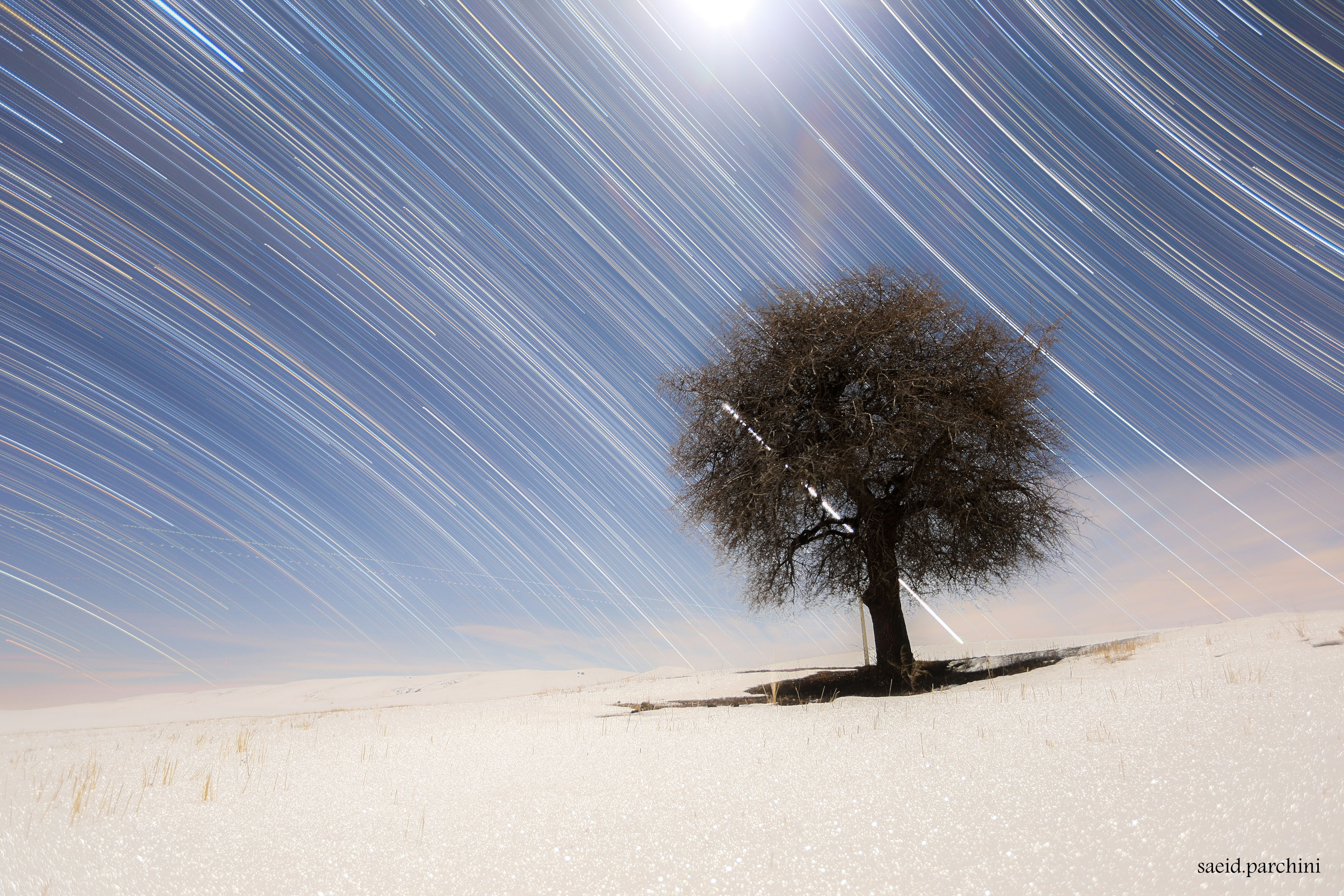
What divides the north from the south? It all has to do with the spin of the Earth. On Earth's surface, the equator is the dividing line, but on Earth's sky, the dividing line is the Celestial Equator -- the equator's projection onto the sky. You likely can't see the Earth's equator around you, but anyone with a clear night sky can find the Celestial Equator by watching stars move. Just locate the dividing line between stars that arc north and stars that arc south. Were you on Earth's equator, the Celestial Equator would go straight up and down. In general, the angle between the Celestial Equator and the vertical is your latitude. The featured image combines 325 photos taken every 30 seconds over 162 minutes. Taken soon after sunset earlier this month, moonlight illuminates a snowy and desolate scene in northwest Iran. The bright streak behind the lone tree is the planet Venus setting. Almost Hyperspace: Random APOD Generator
¿Qué divide el norte del sur? Todo tiene que ver con la rotación de la Tierra. En la superficie terrestre, el ecuador es la línea divisoria, pero en el cielo terrestre, la línea divisoria es el Ecuador Celeste — la proyección del ecuador sobre el cielo. Probablemente no puedas ver el ecuador terrestre a tu alrededor, pero cualquier persona con un cielo nocturno despejado puede encontrar el Ecuador Celeste observando cómo se mueven las estrellas. Simplemente localiza la línea divisoria entre las estrellas que describen arcos hacia el norte y las que describen arcos hacia el sur. Si estuvieras en el ecuador terrestre, el Ecuador Celeste se elevaría directamente hacia arriba y hacia abajo. En general, el ángulo entre el Ecuador Celeste y la vertical es tu latitud. La imagen destacada combina 325 fotografías tomadas cada 30 segundos durante 162 minutos. Tomada poco después del atardecer hace unas semanas, la luz de la luna ilumina una escena nevada y desolada en el noroeste de Irán. El destello brillante detrás del árbol solitario es el planeta Venus en su puesta de sol.