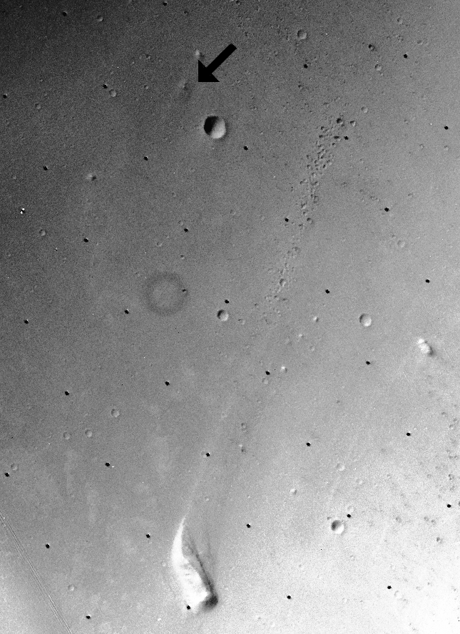
Where is Mars Pathfinder? Follow the arrow in the above picture taken by the Viking Orbiter in 1976. From the surface Mars appears covered with rocks, but from orbit Mars appears covered with craters. However, several familiar features are visible in this photograph. To the left (west) of Sagan Memorial Station are the now-familiar twin peaks that dominate the horizon of many Pathfinder photographs. These hills are about one kilometer from the landing site, twice the planned range of Sojourner. Two craters loom nearby: a small one to the east not easily visible here, and a big one to the south of Pathfinder. The landing site is in the dry flood channel named Ares Vallis.
¿Dónde está Mars Pathfinder? Siga la flecha en la imagen superior, tomada por el Viking Orbiter en 1976. Desde la superficie, Marte parece cubierto de rocas, pero desde la órbita parece cubierto de cráteres. Sin embargo, varias características reconocibles son visibles en esta fotografía. Al oeste (izquierda) de la Estación Memorial Sagan se encuentran los ya familiares picos gemelos que dominan el horizonte en muchas fotografías del Pathfinder. Estas colinas se encuentran a aproximadamente un kilómetro del sitio de aterrizaje, el doble del alcance planificado para el Sojourner. Dos cráteres se destacan en las cercanías: uno pequeño al este, no fácilmente visible aquí, y uno grande al sur del Pathfinder. El sitio de aterrizaje se encuentra en el canal de inundación seco denominado Ares Vallis.