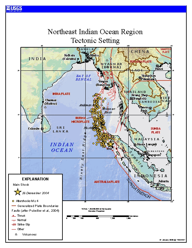
December's 9.0 earthquake has likely shortened Earth's day by about three microseconds and may also have tweaked Earth's rotational wobble. The megathrust earthquake occurred as the Indian tectonic plate slid further beneath the Burma tectonic plate. The earthquake was the fourth most powerful since the year 1900 and triggered tsunamis that tragically killed over 250,000 people in nearby coastal regions. In the above map, the yellow star indicates the location of the main earthquake, while circles show the locations of large aftershocks. The Sumatra-Andaman Islands earthquake's effect on the Earth's rotation was sudden but much smaller than the accumulated effects of other surface events such as an El Nino.
El terremoto de magnitud 9.0 de diciembre probablemente acortó el día terrestre aproximadamente tres microsegundos y también pudo haber alterado el bamboleo rotacional de la Tierra. El megaterremoto ocurrió cuando la placa tectónica india se deslizó aún más bajo la placa tectónica de Birmania. El terremoto fue el cuarto más poderoso desde el año 1900 y desencadenó tsunamis que trágicamente mataron a más de 250.000 personas en regiones costeras cercanas. En el mapa anterior, la estrella amarilla indica la ubicación del epicentro principal del terremoto, mientras que los círculos muestran las ubicaciones de los grandes réplicas sísmicas. El efecto del terremoto de Sumatra e Islas Andamán en la rotación terrestre fue repentino pero mucho menor que los efectos acumulados de otros eventos superficiales como un El Niño.

