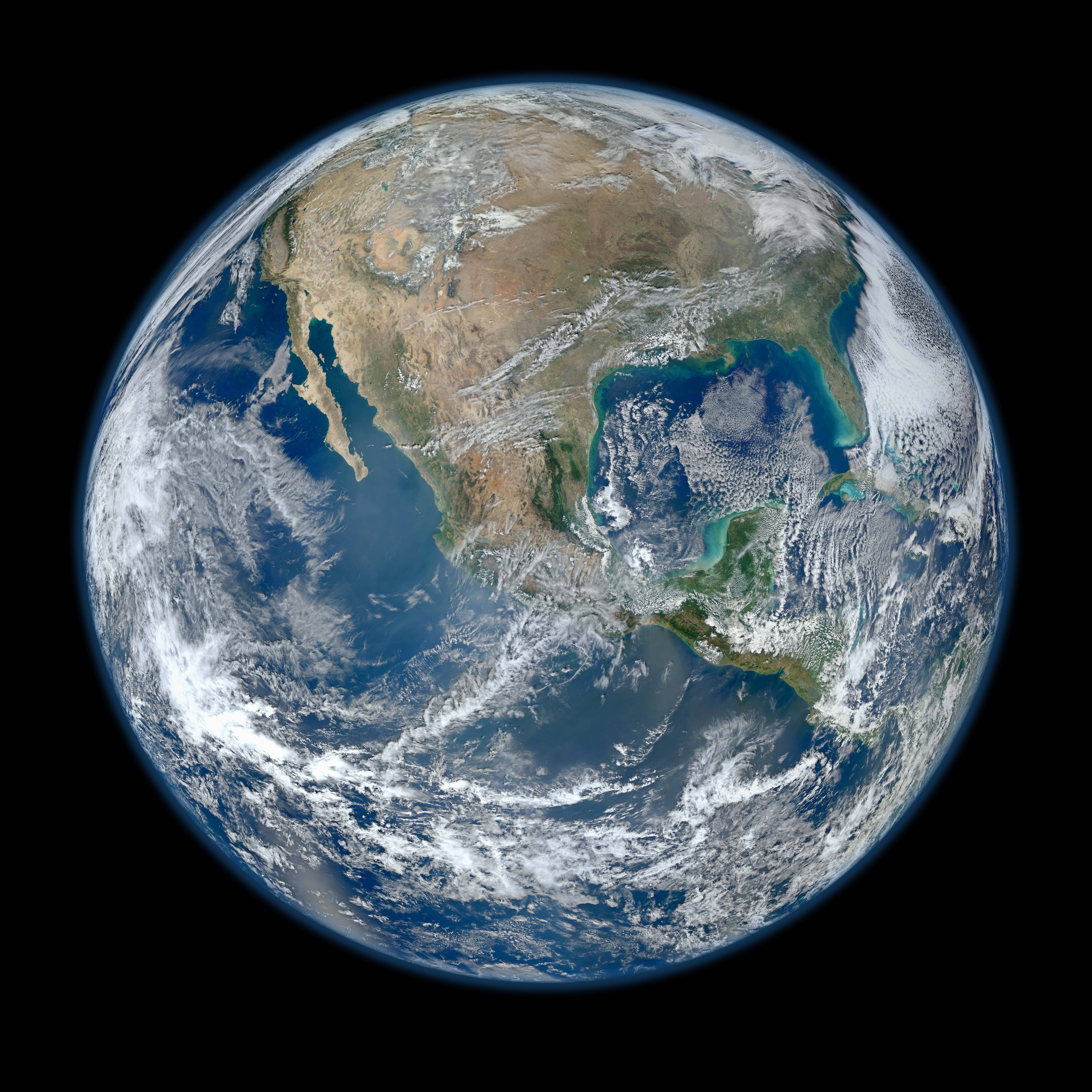
Behold one of the more detailed images of the Earth yet created. This Blue Marble Earth montage shown above -- created from photographs taken by the Visible/Infrared Imager Radiometer Suite (VIIRS) instrument on board the new Suomi NPP satellite -- shows many stunning details of our home planet. The Suomi NPP satellite was launched last October and renamed last week after Verner Suomi, commonly deemed the father of satellite meteorology. The composite was created from the data collected during four orbits of the robotic satellite taken earlier this month and digitally projected onto the globe. Many features of North America and the Western Hemisphere are particularly visible on a high resolution version of the image. Previously, several other Blue Marble Earth images have been created, some at even higher resolution.
Contemple una de las imágenes más detalladas de la Tierra jamás creadas. Este montaje de la Canica Azul —elaborado a partir de fotografías tomadas por el instrumento VIIRS (Visible/Infrared Imager Radiometer Suite) a bordo del nuevo satélite Suomi NPP— muestra numerosos y sorprendentes detalles de nuestro planeta. El satélite Suomi NPP fue lanzado en octubre del año pasado y rebautizado la semana pasada en honor a Verner Suomi, considerado ampliamente el padre de la meteorología satelital. La imagen compuesta fue creada a partir de los datos recopilados durante cuatro órbitas del satélite robótico realizadas a principios de este mes, y proyectada digitalmente sobre el globo terráqueo. Muchos rasgos de América del Norte y del Hemisferio Occidental son especialmente visibles en la versión de alta resolución de la imagen. Con anterioridad, se han creado otras imágenes de la Canica Azul de la Tierra, algunas incluso con mayor resolución.