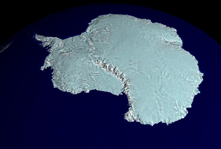
It's not easy to make a map of Antarctica. Earth's southern most continent is so cold and inhospitable that much of it remains unexplored. From space, though, it is possible to map this entire region by radar: by systematically noting how long it takes for radio waves to reflect off the terrain. The Canadian satellite RADARSAT has been orbiting the Earth for the past five years making radar maps, and has recently released the most detailed map of Antarctica ever created. Above is a computer-generated map of Antarctica at relatively low resolution. From the RADARSAT map, scientists have been able to better study this mysterious continent, including information about how ancient ice-shelves are crumbling.
No es fácil elaborar un mapa de la Antártida. El continente más austral de la Tierra es tan frío e inhóspito que gran parte de él permanece inexplorado. Desde el espacio, sin embargo, es posible cartografiar toda esta región mediante radar: registrando sistemáticamente el tiempo que tardan las ondas de radio en reflejarse sobre el terreno. El satélite canadiense RADARSAT ha estado orbitando la Tierra durante los últimos cinco años elaborando mapas de radar, y recientemente ha publicado el mapa más detallado de la Antártida jamás creado. La imagen superior muestra un mapa generado por computadora de la Antártida a una resolución relativamente baja. A partir del mapa RADARSAT, los científicos han podido estudiar mejor este misterioso continente, incluyendo información sobre cómo las antiguas plataformas de hielo se están desmoronando.